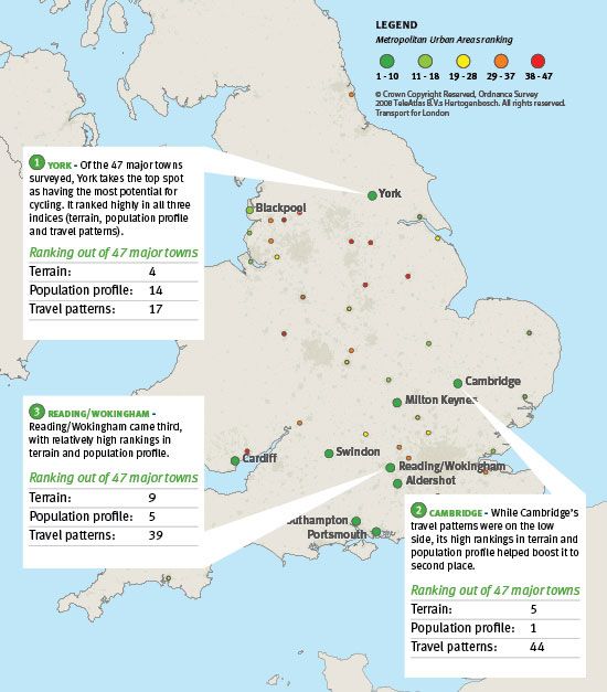
Our new Cycling Potential Index (CPI) ranks the towns and cities in England and Wales by their underlying attractiveness for cycling in terms of terrain, demographics and travel patterns.
We used mapping data on the variability of height to create the terrain index; our TravelStyle geo-demographic system to identify the propensity to cycle among different segments of the population; and the Census Journey to Work to identify the proportion of work trips that are of readily cyclable distance (1-8 km).
These separate indices were combined into a single index and then weighted to reflect the fact that many cycle trips are not for work. The CPI can be used to help devise strategies for cycling for a whole town or city, or at a much more local level. In fact, for towns and cities near the bottom of the ranking, this drilling down would seem to be essential in order to overcome some of the inherent challenges faced. On the other hand, for those fortunate enough to be nearer the top, the question is more about exploiting the underlying potential.


