Steer Home

Main navigation (India)

  • Sectors
    • Transport
      • Active travel
      • Aviation
      • Freight & logistics
      • Ports & maritime
      • Rail, bus & transit
      • Roads, bridges & tunnels
      • Urban & rural mobility
    • Places & communities
      • Community planning
      • Commercial real estate & housing
      • Economic development & regeneration
      • Education & health
      • Leisure, arts & culture
      • Sports & major events
    • Resources
      • Energy
      • Property & land
      • Telecommunications & data
      • Water
  • Services
    • Advisory & financial
      • Market research & intelligence
      • Demand & revenue forecasting
      • Business & financial modelling
      • Capital programme advice & assurance
      • Project financing
      • Commercial & technical due diligence
      • Economic impact
    • Strategy & policy
      • Policy development
      • Business case & advocacy
      • New technologies
      • Regulation & competition
      • Sustainability & climate resilience
      • Strategy & management consulting
    • Planning, delivery & experience
      • Community engagement
      • Network design & operation
      • Cost modelling & strategies
      • Feasibility & detailed design
      • Information & wayfinding
      • Infrastructure & development planning
    • Underpinning capabilities
      • Data science & analytics
      • ESG
      • Equity & inclusion
      • Monitoring & evaluation
  • Projects
  • Insights
Regions
  • Global
  • North America
  • Latin America
  • Europe
  • UK & Ireland
  • India
Search
Contact
  1. Home
  2. Projects
  3. Creating a wayfinding system for Toronto Parks
City of Toronto, Canada

Creating a wayfinding system for Toronto Parks

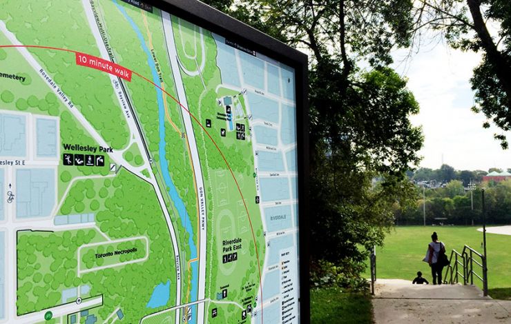
Following on from our successful delivery of Toronto City's TO360 wayfinding strategy we were appointed by the City of Toronto’s Parks, Forestry & Recreation team to deliver an ambitious project aimed at improving wayfinding across the City’s 1600+ parklands. 

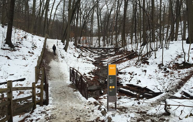
The Toronto Parks & Trails Wayfinding project is being undertaken in two phases. Phase One completed in 2014, created the wayfinding system framework and includes system principles, general style and design guidelines, and an implementation strategy. The framework provides the necessary tools and approach for Phase Two – design and pilot implementation. Phase Two began in January 2015, and implementation is expected to be complete in summer 2017.

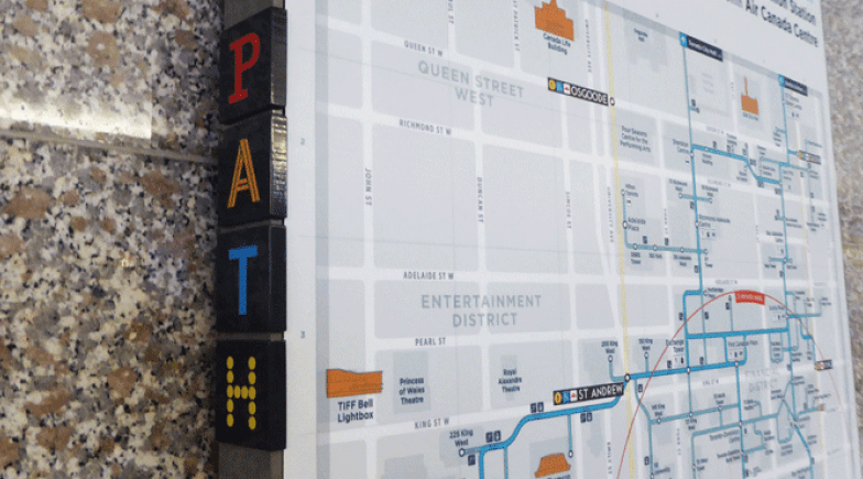
With over 1,600 parks and green spaces modularity and scalability were key to the development of the product and information system design. The use of the TO360 base map as the primary map output for parks is at the core of the information system. By adapting this base map to the differing needs and focus of the parklands we have been able to provide seamless integration between the urban and parks environments.

On
Steer group

We are Steer

Yes, you are in the right place. After 40 years, we have changed our name from Steer Davies Gleave to mark our growing international footprint and our expanding portfolio into sectors beyond transport.

Explore our new website to learn more about Steer: who we are, how we work and what our future holds.

Related projects

  • Toronto city
    View project
    City of Toronto, Canada

    Delivering a multimodal wayfinding strategy for the City of Toronto

  • Toronto path
    View project
    City of Toronto & Financial District BIA, Canada

    Redesigning the wayfinding system for Toronto PATH

  • Brick Lane Threads banner
    View project
    London Borough of Tower Hamlets

    Brick Lane threads connectivity & wayfinding strategy

Complex challenges.
Powerful solutions. 

Footer (India)

  • Sectors
  • People
  • Services
  • About
  • Projects
  • Careers
  • Insights
  • Contact
  • Events
  • Our impact

©2025 Steer      Legal & policies        Cookie settings

Subscribe to our newsletter

  • Facebook
  • Twitter
  • Linkedin
  • Instagram
  • Spotify

Back to top